
If you’ve spent any time searching for the best drone for aerial mapping, you already know the problem: every website has a different “top pick,” the specs are confusing, and half the reviews sound like they were written by someone who has never actually flown a mapping mission. That’s frustrating when you’re about to spend real money on equipment for your survey business, farm, or construction site.
I’ve gone through the current 2026 lineup from pocket-sized multirotors to long-endurance fixed-wing platforms and pulled together this guide to make the choice simple. Whether you need centimeter-level accuracy for a legal boundary survey or just want clean, sharp maps for a small landscaping job, there’s a best drone for aerial mapping here that fits your budget and your workload.
This article breaks down what actually matters when choosing an aerial mapping drone (not just marketing buzzwords), compares the top models side by side in an easy table, and answers the questions people ask most before they buy. No fluff, no confusing jargon just clear, practical advice you can act on today.
What Makes a Drone Good for Aerial Mapping?
Not every camera drone can produce a usable map. A true best drone for aerial mapping is built for photogrammetry or LiDAR work and needs a specific set of features that a regular hobby drone simply doesn’t have.
Here’s what separates a true mapping drone from a toy:
- RTK or PPK positioning: This gives centimeter-level GPS accuracy instead of the 2-3 meter accuracy you get from a normal drone. It’s the single biggest factor in map accuracy.
- A high-resolution, distortion-free camera: Look for a global shutter camera (not rolling shutter) to avoid warped images when the drone is moving fast.
- Long flight time: More minutes in the air means fewer battery swaps and faster coverage of large areas.
- Autonomous grid-flight software: The drone should be able to fly a pre-planned pattern on its own, with consistent image overlap.
- Payload flexibility: The ability to swap in LiDAR, thermal, or multispectral sensors expands what the drone can be used for beyond basic photos.
Keeping these five points in mind will help you judge any aerial mapping drone you come across, even ones not listed in this guide.
Best Drone for Aerial Mapping in 2026
Here’s a quick side-by-side look at the top models so you can compare each best drone for aerial mapping at a glance before reading the full breakdown below.
| Drone | Type | Positioning | Best For | Approx. Price |
| DJI Mavic 3 Enterprise (M3E) | Multirotor | RTK | Portable, all-around mapping | $5,000–$6,500 |
| DJI Matrice 400 + Zenmuse L3 (LiDAR) | Multirotor | RTK | High-accuracy 3D point clouds | $25,000+ |
| DJI Phantom 4 RTK | Multirotor | RTK | Corridor and site surveys | $6,000–$7,000 |
| WingtraOne / WingtraRAY | Fixed-wing VTOL | PPK/RTK | Large-area, survey-grade mapping | $30,000+ |
| senseFly (AgEagle) eBee X | Fixed-wing | PPK/RTK | Long-range professional surveys | $15,000–$25,000 |
| Autel EVO II Pro RTK V3 | Multirotor | RTK/PPK | Budget-friendly professional accuracy | $4,000–$5,500 |
| Yuneec H520 RTK | Multirotor (hexacopter) | GPS/GLONASS | Budget mapping with swappable gimbals | $3,500–$4,500 |
| DJI Mini 4 Pro / Mini 5 Pro | Multirotor | Standard GPS | Beginners, small areas and low budgets | $750–$900 |
| Freefly Astro | Multirotor/VTOL | RTK | Complex terrain, inspection and mapping | $10,000–$15,000 |
Now let’s look at each of these in more detail so you understand exactly why it made the list.
Top Picks: Best Drones for Aerial Mapping
1. DJI Mavic 3 Enterprise – Best Overall Drone for Aerial Mapping
The DJI Mavic 3 Enterprise is one of the most widely used mapping drones in North America, and it’s easy to see why. It comes with a hybrid zoom camera offering up to 56x zoom and a mechanical shutter that prevents motion blur during high-speed surveys. It folds down small enough to fit in a backpack, yet it delivers RTK-grade accuracy that used to require much bigger equipment.
If you want one drone that can handle photogrammetry, site inspection, and quick data capture without carrying a suitcase of gear, this is the best drone for aerial mapping in the “do everything well” category.
Good for: Surveyors, real estate mapping, construction progress tracking, small-to-mid-size job sites.
2. DJI Matrice 400 with Zenmuse L3 (LiDAR) – Best for High-Accuracy 3D Mapping
When photos alone aren’t enough say you need to map terrain hidden under trees, or you need survey data ready for BIM software this combination is the gold standard. It uses LiDAR instead of just photos, which means it can “see” the ground even through vegetation. This makes it the top choice for mining, forestry, and infrastructure corridor mapping where precision below the surface canopy really matters.
Good for: Mining operations, forestry, utility corridors, engineering-grade 3D models.
3. DJI Phantom 4 RTK – Best for Repeatable Site Surveys
The Phantom 4 RTK has been a workhorse in the surveying world for years, and it’s still relevant in 2026 because it’s simple, reliable, and built specifically for RTK mapping missions. It’s a great pick if you’re running the same type of survey over and over, like weekly construction progress reports, and want a proven, no-surprises platform.
Good for: Construction site monitoring, stockpile volume calculations, repeat surveys.
4. WingtraOne / WingtraRAY – Best Fixed-Wing Drone for Large Areas
If you need to map hundreds of acres in a single flight, a multirotor drone just won’t cut it; that’s where fixed-wing VTOL drones like the WingtraRAY come in. It’s a fixed-wing VTOL drone built for aerial surveying and mapping that combines efficient data capture with a connected survey workflow, including high-precision sensors, GNSS positioning, and PPK correction. It can take off and land vertically like a multirotor but fly efficiently like an airplane, covering huge areas without needing a runway.
Good for: Large agricultural fields, mining sites, big infrastructure corridors.
5. senseFly (AgEagle) eBee X – Best for Professional Long-Range Mapping
The eBee X is another fixed-wing option built specifically with professional surveyors in mind. It offers up to 90 minutes of flight time on a single battery, weighs about 3.6 pounds, and delivers absolute accuracy as tight as 0.6 to 1.5 cm, with support for both PPK and RTK workflows. That kind of endurance means fewer trips back to base and more ground covered per mission.
Good for: Large land surveys, mining, agriculture, and government mapping contracts.
6. Autel EVO II Pro RTK V3 – Best Value Professional Mapping Drone
Not everyone has $20,000+ to spend on mapping equipment, and that’s exactly the gap the Autel EVO II Pro RTK V3 fills. It supports both RTK and PPK positioning, giving you professional-grade centimeter accuracy at a fraction of the cost of higher-end platforms. It’s also a solid choice if you’d rather not rely on a single manufacturer for your entire fleet.
Good for: Small survey businesses, freelance mappers, budget-conscious professionals.
7. Yuneec H520 RTK – Best Budget Hexacopter for Mapping
The H520 RTK proves you don’t need to spend a fortune to get decent mapping accuracy. It comes equipped with GPS and GLONASS for highly accurate positioning and features a hot-swappable, interchangeable gimbal system with 360-degree continuous rotation, plus a 7-inch display on the controller for a clear view of your mapping data. As a hexacopter, it also has an extra layer of safety since it can keep flying even if one motor fails.
Good for: Small businesses, students, and anyone getting started with professional mapping on a tighter budget.
8. DJI Mini 4 Pro / Mini 5 Pro – Best Entry-Level Mapping Drone
These aren’t survey-grade drones, but they’re genuinely useful for basic mapping needs like backyard landscaping plans, small farm plots, or hobby-level GIS projects. The DJI Mini 4 Pro and DJI Mini 5 Pro are the most affordable entry points for aerial mapping, and when paired with well-placed ground control points, they can still produce surprisingly usable maps.
Good for: Beginners, hobbyists, and small personal projects with no legal accuracy requirements.
9. Freefly Astro – Best for Complex Terrain and Mixed Missions
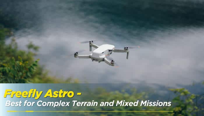
The Freefly Astro is built for people who need more than just mapping; it also handles inspection work well. It uses native RTK positioning through an onboard mission computer, with optional LTE connectivity for networked operations and remote oversight, supporting topographic mapping, volume calculations, corridor surveys, and agricultural analysis.
Good for: Teams that need one drone for both mapping and infrastructure inspection.
Fixed-Wing vs. Multirotor: Which Is the Better Aerial Mapping Drone?
This is one of the most common questions people ask when shopping for the best drone for aerial mapping, so let’s break it down simply.
- Fixed-wing drones fly like small airplanes. They cover large areas quickly, often flying for 60-120 minutes on one battery, and are ideal for open land like farms, mining sites, or big construction corridors.
- Multirotor drones hover like helicopters. They’re better for tight spaces, detailed inspections, and areas with obstacles like trees or buildings, but they cover less ground per flight.
If your job involves mapping small, detailed sites, go with a multirotor. If you’re covering hundreds of acres of open land, a fixed-wing (or VTOL fixed-wing) is the smarter investment.
Photogrammetry vs. LiDAR: Which Mapping Method Do You Need?
Most models of the best drone for aerial mapping use one of two methods to build a map:
1. Photogrammetry: Takes hundreds of overlapping photos and stitches them together using software to build a 3D model. This works great in open areas with clear visibility.
2. LiDAR: Uses laser pulses to measure distance, which lets it “see through” gaps in trees and vegetation to map the actual ground surface. This is essential for forestry, mining, and terrain mapping.
If your project involves dense vegetation or you need to see the bare earth underneath, LiDAR is worth the extra cost. For most everyday mapping jobs, photogrammetry does the job just fine and costs much less.
How to Choose the Best Drone for Aerial Mapping for Your Needs
Picking the right best drone for aerial mapping comes down to answering a few honest questions about your own project:
- What’s your budget? Entry-level mapping starts around $750, while professional RTK setups start around $4,000-$6,000, and LiDAR platforms can run well past $20,000.
- How much area do you need to cover? Small sites favor multirotors; large open land favors fixed-wing drones.
- How accurate does your data need to be? Legal surveys and construction deliverables need RTK or PPK. Casual mapping doesn’t.
- Do you need to see through vegetation? If yes, you need LiDAR, not just a camera.
- Will you fly it often? Frequent professional use justifies a bigger upfront investment.
Answering these honestly will point you toward the right best drone for aerial mapping for your situation, instead of just buying whatever ranks first on a “top 10” list.
Final Thoughts
There isn’t one single best drone for aerial mapping that works for every person and every job; it really depends on your budget, the size of the area you’re covering, and how accurate your final map needs to be. For most professionals, the DJI Mavic 3 Enterprise offers the best balance of portability, accuracy, and price. If you’re covering large open areas, a fixed-wing platform like the WingtraRAY or eBee X will save you serious time. And if you’re just getting started, an entry-level drone paired with good ground control points can still get the job done.
Whatever you choose, focus on matching the drone’s strengths to your actual project needs rather than chasing the highest spec sheet; that’s the real key to getting accurate, reliable aerial maps every time.
Best Drone for Aerial Mapping FAQs
1. What is the most accurate drone for aerial mapping?
When people ask which is the best drone for aerial mapping in terms of raw accuracy, the answer is usually a drone using RTK or PPK positioning combined with LiDAR, like the DJI Matrice 400 with the Zenmuse L3 sensor, since it currently offers the highest accuracy for professional mapping work.
2. Do I need RTK for aerial mapping?
Only if your project requires survey-grade accuracy, such as legal boundary surveys or engineering deliverables. For casual mapping, a standard GPS drone with ground control points is usually accurate enough.
3. Can a cheap drone be used for aerial mapping?
Yes, for small, non-legal projects. Drones like the DJI Mini 4 Pro can produce usable maps when combined with careful flight planning and ground control points, though they won’t match RTK-level accuracy.
4. What’s the difference between RTK and PPK?
RTK corrects GPS positioning in real time during the flight, so you can verify accuracy on-site. PPK records the data and corrects it afterward, which works even without a live internet or cell connection.